Pictures in chronological order!


We started from Pasar Agung temple, at 1:30am.
About 5 hours later with a torchlight on our head and a visibility of approximately 5 metres,
we could somehow see the peak and were still making our way towards it.
My thoughts during the ascent was as follows:
2am - WHY IN THE WORLD DID I CHOOSE TO CLIMB A MOUNTAIN WHYY???
3am - It's okay to be slow, safety is more important..it's okay to be slow.. *chants repeatedly*
4am - Where is the next rock I can hold and transfer my weight to without losing my life????
5am - wtf my gloves are torn, my beloved touch screen fingertips gloves :(
6am - kanchiong, the sun is on it's way out and I am not at the summit YET urghhh frustrating
Also, at about 5am, I experienced altitude sickness,
I have a headache that feels very different from a normal headache.
But mostly, I just continued with the climb and focus on the next step,
and try to bluff my body into thinking that it IS NOT altitude sickness.
>>>Fast forward, from here onwards it was about 6 plus in the morning.


The best sunrise ever.
Sunrises are beautiful,
But werking for it is a whole new kind of beautiful.
I started with a tee-shirt.
By the time I reach the summit, I had 3 layers of clothes and a torn pair of gloves.

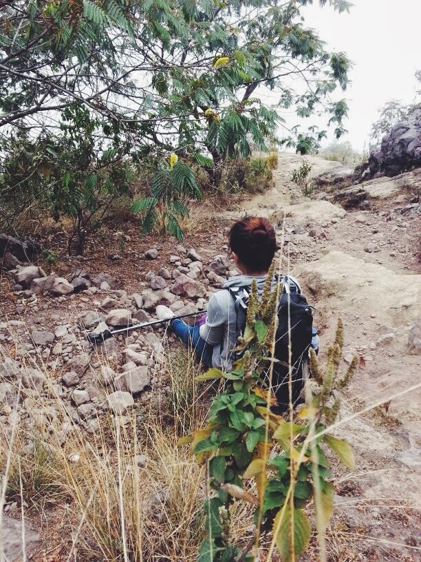
It kinda looks like 45degrees incline here,
but pictures are deceiving.
At the last hour, it was 70-90degrees rock climbing.
There are less steep paths so it goes like...
__
___/
/
---/


We are possibly the only Asians on this summit that day (aside from the guides).
Met a group of Singaporeans but they chosed not to go up and started a campfire somewhere in the middle of the mountain.


The clouds became more well-defined as the sun rose,
clearly separated from the rest of the sky.

Here is Gung Bawa starting a fire and cooking banana pancakes.


Cold and tired ksh.


Rolls of clouds beneath our feets,
- what we see out of a plane window.


"Check out my pink gloves yehhh"


I think I was pointing at Mt Batur gracefully...


I wanted to stand up, but I was really tired and giddy and overwhelmed.
So I didn't. :(
Regrets.
NVM cangobackagain


From here onwards, we started to make our way down.

Going up took us about 5 hours, while going down took us 8 hours.
The journey down was horrible, I fell down at least 30 times. Or maybe even 50 times.
There were times we were so tired from falling down, we just sit down and try to paddle our way down using out hands. The descent was such a horrible experience.
Legs were wobbly like jam.
Here, I FELL DOWN AGAIN.
Felt so dejected already, I just put down my hiking stick and take our snickers to eat.
I fell down until my palms were numb.


LOL we went to find a secluded spot and started taking shadow pictures.
Suddenly we heard Gungbawa giggling and we were so embarrassed.

Here are the two Parisians who trekked with us.
Omg i forgot their names, I am really bad with names.


Sidetrack to a bit of summit pictures:


The volcano crater


And home sweet home to where we lay paralysed.
Conversations in the morning go like
"can you sit up?"
"no... i can't.."
"can you help me to take water? i can't move..."
Through this hike, I discovered muscles that I didn't know I have.
It has been an amazing trip.
And I am so glad the weather has been so kind to us.
We started the trek with a sky clear full of stars.
And reached the summit with a sky clear full of well-defined clouds.
And when we reached the bottom of the mountain and were about to return back to City,
it started to drizzle just at the right time.
Mount Agung:
Also known as Gunung Agung is the tallest volcano/mountain in Bali, Indonesia.
It's standing at 3,031metres. It erupted in 1963 and is still an active volcano.
Just a short interesting excerpt here:
1963-64 eruption[edit]
On February 18, 1963, local residents heard loud explosions and saw clouds rising from the crater of Mount Agung. On February 24, lavabegan flowing down the northern slope of the mountain, eventually traveling 7 km in the next 20 days. On March 17, the volcano erupted (VEI 5), sending debris 8 to 10 km into the air and generating massive pyroclastic flows.[5] These flows devastated numerous villages, killing approximately 1500 people. Cold lahars caused by heavy rainfall after the eruption killed an additional 200. A second eruption on May 16 led to pyroclastic flows that killed another 200 inhabitants.[6]
The lava flows missed, sometimes by mere yards, the Mother Temple of Besakih. The saving of the temple is regarded by the Balinese people as miraculous and a signal from the gods that they wished to demonstrate their power but not destroy the monument the Balinese faithful had erected.
It takes about 10 hours in total, for the ascent and descent.
People usually do a sunrise trek starting at night and reaching the summit just in time for sunrise.
The car ride from Seminyak is about 2 hours to the starting point.
Temperature at the summit is about 5-10 degrees celsius,
a long sleeve plus a jacket/windbreaker would suffice.

The shorter volcano beside would be Mount Batur.
There are two more well-known guides in Bali, their names are all over Tripadvisor,
they are Wayan and Gung Bawa.
Initially, I wanted to engage Wayan but after a few email correspondences,
he was unable to take us on the dates we wanted cos he had other customers already.
This guy is really popular over the internet.
But anyway! We met him on the summit and he asked for my name.
I think he recognized the Asian name as the customer he had to drop.
If you have very good body strength, you CAN go without a guide.
Just drive to the starting point and follow closely behind anybody or any group.
It should be fine.
There is no civilisation/village/water/food along the way, so be sure to carry all the essentials.
In all, it was a fulfilling and rewarding climb.
And a fats-burning one as well cos you move non-stop for 10 hours.


